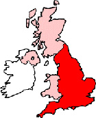
Leigh-on-Sea Maps - District Map Leigh-on-Sea Essex
Useful road map of Leigh-on-Sea district, town centre and surroundings.
 |
||
Local District Street Map for Leigh-on-Sea Essex England
Leigh-on-Sea Maps: With this easy to print map, you can see local districts of Leigh-on-Sea, its central area and surroundings within the county of Essex, England in the United Kingdom. Using this detailed Leigh-on-Sea map, you can find your way around the town and locate streets, roads and facilities in Leigh-on-Sea.
The view of the map shown on this page is of the town centre area of Leigh-on-Sea, use the minus ( - ) button (bottom right of map) to view districts of Leigh-on-Sea and surrounding areas, villages, towns and points of interest. Leigh-on-Sea district map. By viewing this map you can judge roughly how far Leigh-on-Sea is from these nearby places and see the distance between.
Things you can view include: Leigh Road Baptist Church, Oak Wood, The A13 (London Road), Leigh-on-Sea Train Station (Railway Station), Leigh-on-Sea Town Council, Leigh Library, Rileys Pool & Snooker Club, Leigh North Street Junior School, Southend Golf Club, Ye Olde Smack, Leigh-on-Sea High St, Eastwood Park, Central Leigh-on-Sea Bus Stop (Belton Way East), The Crooked Billet Pub, Chalkwell Park, Blenheim Park, Leigh Elim Church, St Clements Church, Cliff Parade Leigh-on-Sea, Grand Parade Leigh-on-Sea, Chalkwell Train Station and more (you may need to utilize "view on Google maps" link).
England Maps: Leigh-on-Sea, Essex street map. Printable map of Leigh-on-Sea England.
Leigh-on-Sea districts, Leigh-on-Sea streets, Leigh-on-Sea roads, Leigh-on-Sea attractions.
More Local District Maps:
- Detailed Map Maldon District England
- Detailed Map Billericay District England
- Detailed Map South Woodham Ferrers District England
- Detailed Map Ingatestone District England
- Detailed Map Langdon Hills District England
Town centre map Leigh-on-Sea, Essex, England.