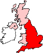
Ipswich Maps - District Map Ipswich Suffolk
Useful road map of Ipswich district, town centre and surroundings.
 |
||
Local District Street Map for Ipswich Suffolk England
Ipswich Maps: With this easy to print map, you can see local districts of Ipswich, its central area and surroundings within the county of Suffolk, England in the United Kingdom. Using this detailed Ipswich map, you can find your way around the town and locate streets, roads and facilities in Ipswich.
The view of the map shown on this page is of the town centre area of Ipswich, use the minus ( - ) button (bottom right of map) to view districts of Ipswich and surrounding areas, villages, towns and points of interest. Ipswich district map. By viewing this map you can judge roughly how far Ipswich is from these nearby places and see the distance between.
Things you can view include: Ipswich Railway Station (Train Station), Alexandra Park, Christchurch Mansion & Wolsey Art Gallery, Cineworld Ipswich, Neptune Marina, University Campus Suffolk, St Helens Primary School, the Golden Lion Hotel, Carr Street Post Office, St Matthews Church, The River Orwell, St Mary-le-Tower Church, Unitarian Meeting House, Manor Social Club & Ballroom, Butter Market Shopping Centre, the Balck Horse Pub, Sherrington Road Park, Gippeswyk Park, the Corn Exchange, Suffolk County Council Offices, the New Wolsey Theatre, St Margaret's C of E Church, Landseer Park, Big Pond, Racecourse Recreation Ground, Ipswich Mosque, Ipswich Derby Road Station, the Brasserie Restaurant, Ipswich Town Hall Galleries, St Mary at the Elms Parish Church, Ipswich Station, Suffolk New College, Holywells Park, Ipswich Museum, Cafe Giardino and more (you may need to utilize "view on Google maps" link).
England Maps: Ipswich, Suffolk street map. Printable map of Ipswich England.
Ipswich districts, Ipswich streets, Ipswich roads, Ipswich attractions.
More Local District Maps:
- Detailed Map Eye District England
- Detailed Map Southwold District England
- Detailed Map Orford District England
- Detailed Map Brandon District England
- Detailed Map Felixstowe District England
Town centre map Ipswich, Suffolk, England.