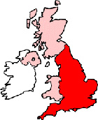
Dorset Maps - Dorset County Map
Useful road map of Dorset county, its districts and surroundings.
 |
||
Local County Street Map for Dorset England
Dorset Maps: With this easy to print map, you can see local districts of Dorset and its many towns and villages. Using this detailed Dorset map, you can find your way around the county of Dorset and locate streets, roads and facilities in the region. The view of the map shown on this page is of the general Dorset area, with some of surrounding counties. You can judge roughly how the county lies within the UK and related to other counties.
Dorset cities, Dorset towns, Dorset villages, Dorset attractions.
More Local District Maps:
- Detailed Map Lyme Regis District England
- Detailed Map Blandford Forum District England
- Detailed Map Swanage District England
- Detailed Map Verwood District England
- Detailed Map Gillingham District England
- Detailed Map Shaftesbury District England
- Detailed Map Chickerell District England
- Detailed Map Christchurch District England
- Detailed Map Bridport District England
- Detailed Map Bournemouth District England
- Detailed Map Sherborne District England
- Detailed Map Dorchester District England
- Detailed Map Wareham District England
- Detailed Map Highcliffe District England
- Detailed Map Poole District England
- Detailed Map Stalbridge District England
- Detailed Map Wimborne Minster District England
- Detailed Map Weymouth District England
- Detailed Map Ferndown District England
- Detailed Map Sturminster Newton District England
- Detailed Map Beaminster District England